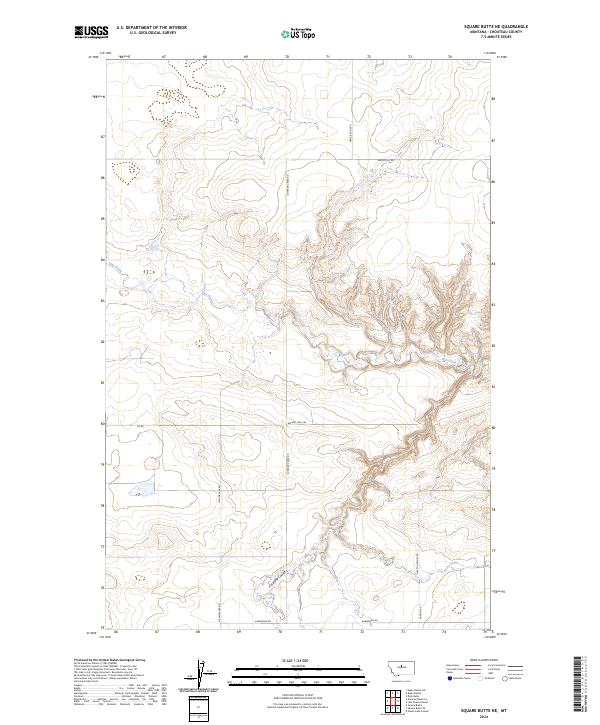
2024 Map of Square Butte NE
USGS Topo · Published 2024About this map
Chouteau County's rural landscape is defined here by the winding course of Flat Creek, which carves a deep valley across the northeastern corner of the quadrangle. This 2024 survey illustrates a region largely partitioned by the Public Land Survey System, including townships t23n r13e and t22n r13e, where the terrain transitions from open high plateaus to intricate coulees. The transportation network reflects a long history of land use, featuring the aptly named Wagon Trail Rd alongside modern local connectors. To the south, Cut Bank Coulee provides another significant drainage point, while the local road names such as Happy Hollow Rd and Prairie Edge Rd offer a glimpse into the localized geography and family-oriented naming conventions that characterize this Montana interior.
Find a feature on this map
14 named features on this map. Tap any name to fly to it.
Don’t see what you’re looking for? This feature index may not catch every label — zoom into the map to look around manually.
Map Details
Editions of this 2024 Square Butte NE Map
This is the sole edition of this map. No revisions or reprints were ever made.
Other maps of this area

1890 · Fort Benton
USGS Topo · 1:250,000

1892 · Fort Benton
USGS Topo · 1:250,000

1897 · Fort Benton
USGS Topo · 1:250,000

1953 · Eagle Buttes
USGS Topo · 1:24,000

1953 · Last Chance Bench
USGS Topo · 1:24,000

1954 · Great Falls
USGS Topo · 1:250,000

1954 · Dark Butte
USGS Topo · 1:24,000

1954 · Lewistown
USGS Topo · 1:250,000

1957 · Great Falls
USGS Topo · 1:250,000

1959 · Lewistown
USGS Topo · 1:250,000