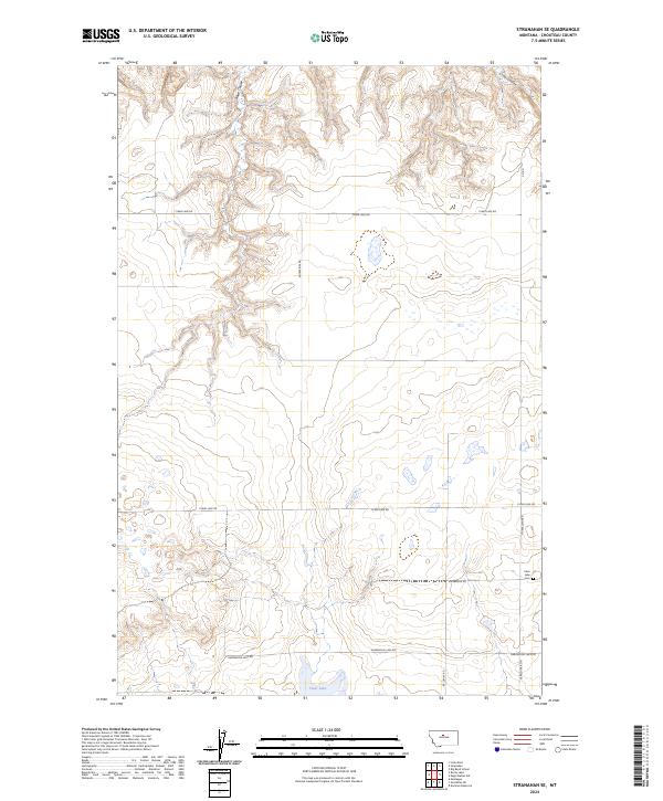
2024 Map of Stranahan SE
USGS Topo · Published 2024About this map
Clear Lake Cem stands as a focal point for genealogical research in this rural Chouteau County landscape, situated near the intersection of Danbrook Rd and N Geraldine Rd. The terrain is defined by the significant drainage patterns of Rowe Coulee and Crow Coulee, which carve through the high plains toward the namesake Clear Lake in the southern portion of the sheet. A network of section-line roads, including Clear Lake Rd and Enterprise Rd, illustrates the organized agricultural partition of the Big Sandy and Geraldine region. The mapping of these ephemeral water bodies and isolated lake beds reveals a landscape adapted to seasonal moisture, where the placement of Hardwood Lake Rd and Ric Oshay Rd facilitates movement between remote farmsteads and rural landmarks.
Find a feature on this map
17 named features on this map. Tap any name to fly to it.
Don’t see what you’re looking for? This feature index may not catch every label — zoom into the map to look around manually.
Map Details
Editions of this 2024 Stranahan SE Map
This is the sole edition of this map. No revisions or reprints were ever made.
Other maps of this area

1890 · Fort Benton
USGS Topo · 1:250,000

1892 · Fort Benton
USGS Topo · 1:250,000

1897 · Fort Benton
USGS Topo · 1:250,000

1953 · Rocky Lake
USGS Topo · 1:24,000

1953 · Loma East
USGS Topo · 1:24,000

1953 · Big Bend School
USGS Topo · 1:24,000

1953 · Stranahan
USGS Topo · 1:24,000

1954 · Great Falls
USGS Topo · 1:250,000

1957 · Great Falls
USGS Topo · 1:250,000
1972 · Eagle Buttes SW
USGS Topo · 1:24,000