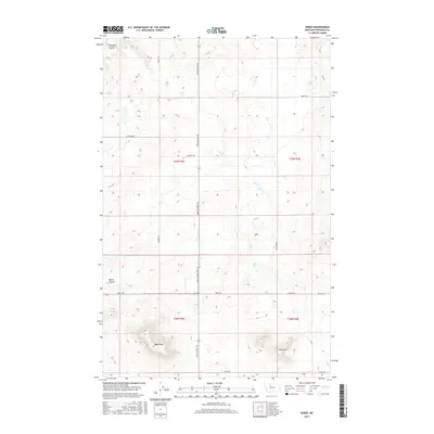
2017 Map of Knees
USGS Topo · Published 2017About this map
West Knee and East Knee anchor this section of Chouteau County, where the high plains of north-central Montana are defined by a grid of agricultural roads and significant topographical breaks. The land is dissected by deep drainage features including Pondera Coulee in the northwest and Basin Coulee to the west. A network of local routes like Bootlegger Trl, Brady Rd, and Genou Rd provides access across the township sections of T27N R3E and T26N R4E. This 2017 survey reflects the persistent geometry of Montana's rural land management, where named trails such as Woods Trl and Prairie Dr follow section lines across an open landscape. The contour intervals reveal the distinct elevation changes at the "Knees," providing a detailed look at the relief and water runoff patterns that shape the region's ranching and wheat-farming environment.
Find a feature on this map
18 named features on this map. Tap any name to fly to it.
Don’t see what you’re looking for? This feature index may not catch every label — zoom into the map to look around manually.
Map Details
Editions of this 2017 Knees Map
This is the sole edition of this map. No revisions or reprints were ever made.
Other maps of this area

1886 · Great Falls
USGS Topo · 1:250,000

1949 · Timber Coulee
USGS Topo · 1:62,500

1950 · Timber Coulee
USGS Topo · 1:62,500

1950 · Dent Bridge
USGS Topo · 1:62,500

1954 · Great Falls
USGS Topo · 1:250,000

1954 · Shelby
USGS Topo · 1:250,000

1957 · Great Falls
USGS Topo · 1:250,000

1958 · Shelby
USGS Topo · 1:250,000

1970 · Carlson Coulee
USGS Topo · 1:24,000

1970 · Knees NE
USGS Topo · 1:24,000