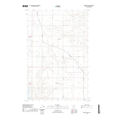
2020 Map of Lonetree Coulee
USGS Topo · Published 2020About this map
The Missouri River cuts through the southwestern corner of this landscape, marking the primary topographical boundary in a region defined by high plains and deeply cut drainages. In Chouteau County, the drainage network of Big Sandy Cr and Little Sandy Cr dictates the local geography, with seasonal watercourses carving distinct breaks into the terrain. Transportation in the area relies on a series of historical thoroughfares, most notably the prominent Judith Landing Rd, which provides a vital link across the high country. Local routes such as Mountain View Rd and Sheep Coulee Rd navigate the undulating elevation, reflecting a land usage focused on ranching and large-scale agriculture. The network of trails and unimproved roads, including Lonetree Trl and Kamut Ln, reveals the sparse but intentional infrastructure required to maintain this stretch of the Big Sky state.
Find a feature on this map
16 named features on this map. Tap any name to fly to it.
Don’t see what you’re looking for? This feature index may not catch every label — zoom into the map to look around manually.
Map Details
Editions of this 2020 Lonetree Coulee Map
This is the sole edition of this map. No revisions or reprints were ever made.
Other maps of this area

1890 · Fort Benton
USGS Topo · 1:250,000

1892 · Fort Benton
USGS Topo · 1:250,000

1897 · Fort Benton
USGS Topo · 1:250,000

1919 · Big Sandy
USGS Topo · 1:125,000

1953 · Verona
USGS Topo · 1:24,000

1953 · Big Bend School
USGS Topo · 1:24,000

1953 · Lonetree Coulee
USGS Topo · 1:24,000

1953 · Pilot Rock
USGS Topo · 1:24,000

1953 · Havre
USGS Topo · 1:250,000

1954 · Great Falls
USGS Topo · 1:250,000