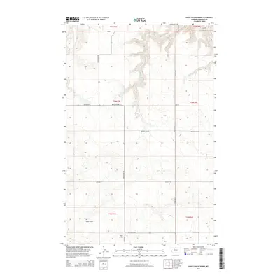
2014 Map of Sheep Coulee Spring
USGS Topo · Published 2014About this map
Sheep Coulee Spring serves as a vital water source in this section of Chouteau County, where the high plains are carved by seasonal drainages and a network of section-line roads. This survey of the Montana landscape reveals a sparse, rural environment defined by topographical features like Wolf Coulee in the northeast and the wide reach of Sheep Coulee to the south. The human footprint is marked by long-standing transit routes, including the prominent Bootlegger Trl and Promised Land Rd, which reflect the region's agricultural and frontier history. Land use is organized around the Public Land Survey System, with township boundaries such as t24n r3e and t25n r4e meeting here. The map traces the rugged descent toward Alkali Coulee, illustrating the interplay between the dry upland plateaus and the deep coulees that provide natural drainage for the territory.
Find a feature on this map
22 named features on this map. Tap any name to fly to it.
Don’t see what you’re looking for? This feature index may not catch every label — zoom into the map to look around manually.
Map Details
Editions of this 2014 Sheep Coulee Spring Map
This is the sole edition of this map. No revisions or reprints were ever made.
Other maps of this area

1886 · Great Falls
USGS Topo · 1:250,000

1948 · Portage
USGS Topo · 1:62,500

1949 · Portage
USGS Topo · 1:62,500

1949 · Timber Coulee
USGS Topo · 1:62,500

1949 · Great Falls
USGS Topo · 1:62,500

1950 · Timber Coulee
USGS Topo · 1:62,500

1950 · Dent Bridge
USGS Topo · 1:62,500

1951 · Great Falls
USGS Topo · 1:62,500

1954 · Great Falls
USGS Topo · 1:250,000

1957 · Great Falls
USGS Topo · 1:250,000