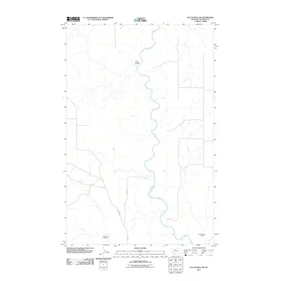
2011 Map of Day School SW
USGS Topo · Published 2011About this map
The Marias River meanders through this portion of Chouteau County, creating a deeply incised drainage system characterized by numerous side coulees. This 2011 survey illustrates the rural landscape where topography is defined by features like Sheep Coulee and Slide Out Coulee, which drain toward the river's main channel. The presence of Chip Creek in the southwest and Lone Tree Coulee in the southeast highlights the complex water-carved geography of the Montana plains.
Find a feature on this map
7 named features on this map. Tap any name to fly to it.
Don’t see what you’re looking for? This feature index may not catch every label — zoom into the map to look around manually.
Map Details
Editions of this 2011 Day School SW Map
This is the sole edition of this map. No revisions or reprints were ever made.
Other maps of this area

1890 · Fort Benton
USGS Topo · 1:250,000

1892 · Fort Benton
USGS Topo · 1:250,000

1897 · Fort Benton
USGS Topo · 1:250,000

1953 · Loma West
USGS Topo · 1:24,000

1954 · Great Falls
USGS Topo · 1:250,000

1954 · Shelby
USGS Topo · 1:250,000

1957 · Great Falls
USGS Topo · 1:250,000

1958 · Shelby
USGS Topo · 1:250,000
1964 · Fort Benton NW
USGS Topo · 1:24,000
1964 · Day School SW
USGS Topo · 1:24,000