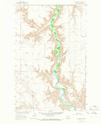
1964 Map of Day School SW
USGS Topo · Published 1966About this map
The winding Marias River carves a deep valley through this Chouteau County landscape as it appeared in the mid-1960s. This survey, conducted as part of the Missouri River Basin development program, shows a region defined by its drainage systems and agricultural infrastructure. Numerous coulees, such as Sheep Coulee, Lone Tree Coulee, and Slide Out Coulee, slice through the surrounding plains toward the riverbed. Human activity is focused on ranching and storage, evidenced by the presence of a Corral and clusters of Storage Bins scattered across the high ground. The map detail is particularly useful for locating small water sources like a Spring tucked into a side coulee, and tracing the intermittent flow of Chip Creek. The lack of formal townsites highlights the isolated, pastoral nature of the river breaks during this era of Montana's history.
Find a feature on this map
12 named features on this map. Tap any name to fly to it.
Don’t see what you’re looking for? This feature index may not catch every label — zoom into the map to look around manually.
Map Details
Editions of this 1964 Day School SW Map
This is the sole edition of this map. No revisions or reprints were ever made.
Other maps of this area

1890 · Fort Benton
USGS Topo · 1:250,000

1892 · Fort Benton
USGS Topo · 1:250,000

1897 · Fort Benton
USGS Topo · 1:250,000

1953 · Loma West
USGS Topo · 1:24,000

1954 · Great Falls
USGS Topo · 1:250,000

1954 · Shelby
USGS Topo · 1:250,000

1957 · Great Falls
USGS Topo · 1:250,000

1958 · Shelby
USGS Topo · 1:250,000
1964 · Fort Benton NW
USGS Topo · 1:24,000
1964 · Day School
USGS Topo · 1:24,000