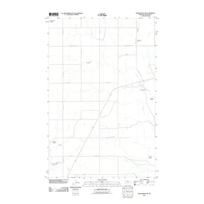
2011 Map of Kenilworth SW
USGS Topo · Published 2011About this map
Twelvemile Coulee and Sixmile Coulee define the drainage patterns of this Chouteau County landscape, illustrating a region shaped by water management and rural accessibility. The map reveals an extensive network of earthen structures used for water retention, including Sumo Dam, Beirwagen Dam, and Moncarpic Dam, which are critical for supporting agriculture and livestock in this semiarid environment. A strictly organized grid of rural roads, such as Rudyard Rd, Stranahan Rd, and Houston Rd, provides the backbone for local transit between isolated homesteads and grazing lands. These features, along with the distinct paths of Spring Coulee and Dry Fork Coulee, show how the modern geography of north-central Montana remains deeply tied to the careful control of seasonal water flow through a series of named dams and natural coulees.
Find a feature on this map
21 named features on this map. Tap any name to fly to it.
Don’t see what you’re looking for? This feature index may not catch every label — zoom into the map to look around manually.
Map Details
Editions of this 2011 Kenilworth SW Map
This is the sole edition of this map. No revisions or reprints were ever made.
Other maps of this area

1890 · Fort Benton
USGS Topo · 1:250,000

1892 · Fort Benton
USGS Topo · 1:250,000

1897 · Fort Benton
USGS Topo · 1:250,000

1906 · Lonesome
USGS Topo · 1:62,500

1919 · Big Sandy
USGS Topo · 1:125,000

1953 · Boggs Island
USGS Topo · 1:24,000

1953 · Loma East
USGS Topo · 1:24,000

1953 · Loma West
USGS Topo · 1:24,000

1953 · Stranahan
USGS Topo · 1:24,000

1954 · Great Falls
USGS Topo · 1:250,000