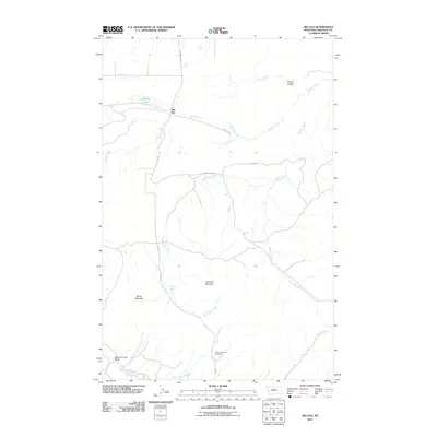
2011 Map of Big Sag
USGS Topo · Published 2011About this map
Gossack Mountain and Harris Mountain dominate the central landscape of this Chouteau County region, where the terrain is defined by a complex network of coulees and seasonal drainages. The settlement at Big Sag sits at a critical junction of local transit routes, including Big Sag Dr and Highwood Rd, positioned near the intermittent waters of Big Sag Lake.
Find a feature on this map
20 named features on this map. Tap any name to fly to it.
Don’t see what you’re looking for? This feature index may not catch every label — zoom into the map to look around manually.
Map Details
Editions of this 2011 Big Sag Map
This is the sole edition of this map. No revisions or reprints were ever made.
Other maps of this area

1890 · Fort Benton
USGS Topo · 1:250,000

1892 · Fort Benton
USGS Topo · 1:250,000

1897 · Fort Benton
USGS Topo · 1:250,000

1954 · Great Falls
USGS Topo · 1:250,000

1954 · Rice Reservoir
USGS Topo · 1:24,000

1956 · Highwood
USGS Topo · 1:62,500

1956 · Belt
USGS Topo · 1:62,500

1957 · Great Falls
USGS Topo · 1:250,000
1972 · Shonkin NW
USGS Topo · 1:24,000
1972 · Shonkin
USGS Topo · 1:24,000