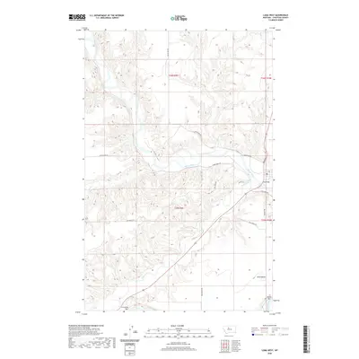
2020 Map of Loma West
USGS Topo · Published 2020About this map
The Marias River carves a deeply dissected canyon through the Chouteau County badlands before its confluence with the Teton and Missouri rivers. This landscape is defined by its dramatic elevation changes, with the high plains of Rowe Bench overlooking the river valley below. Near the eastern edge of the map, Loma Bridge provides a crossing near the site of the historic Loma Ferry Rd, while the southern reaches feature the curious landmark of Crocon du Nez. The topography is a maze of drainage systems like Chip Cr and narrow coulees, etched into the terrain between sprawling sections of public land. Transportation is restricted to rugged corridors such as Vimy Ridge Rd and Colony Bay Rd, reflecting a region dominated by ranching and the natural contours of the northern Missouri River breaks.
Find a feature on this map
21 named features on this map. Tap any name to fly to it.
Don’t see what you’re looking for? This feature index may not catch every label — zoom into the map to look around manually.
Map Details
Editions of this 2020 Loma West Map
This is the sole edition of this map. No revisions or reprints were ever made.
Other maps of this area

1890 · Fort Benton
USGS Topo · 1:250,000

1892 · Fort Benton
USGS Topo · 1:250,000

1897 · Fort Benton
USGS Topo · 1:250,000

1919 · Big Sandy
USGS Topo · 1:125,000

1953 · Rocky Lake
USGS Topo · 1:24,000

1953 · Loma East
USGS Topo · 1:24,000

1953 · O'Hanlon Coulee
USGS Topo · 1:24,000

1953 · Loma West
USGS Topo · 1:24,000

1954 · Great Falls
USGS Topo · 1:250,000

1954 · Fort Benton
USGS Topo · 1:24,000