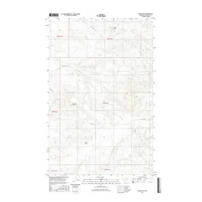
2017 Map of Table Butte
USGS Topo · Published 2017About this map
Table Butte rises as the primary landmark in this section of Chouteau County, anchoring a landscape defined by deep drainages and rural high plains. The terrain is marked by significant erosion features, most notably Coal Mine Coulee and Snake Coulee, which cut through the township boundaries. A network of primitive and local roads, including Coal Mine Rd and Camp Creek Rd, provides access across the various forks of Gorman Creek. The drainage patterns here are complex, with the N Fork Gorman Cr and S Fork Gorman Cr converging to join the main stem of the creek, while the southern reaches of the map are defined by the flow of Frenchman Creek and Big Sandy Creek. These watercourses and named coulees suggest a history of local resource extraction or grazing, typical of the Montana plains in the early twenty-first century.
Find a feature on this map
20 named features on this map. Tap any name to fly to it.
Don’t see what you’re looking for? This feature index may not catch every label — zoom into the map to look around manually.
Map Details
Editions of this 2017 Table Butte Map
This is the sole edition of this map. No revisions or reprints were ever made.
Other maps of this area

1904 · Boxelder
USGS Topo · 1:62,500

1906 · Boxelder
USGS Topo · 1:62,500

1919 · Big Sandy
USGS Topo · 1:125,000

1953 · Lonetree Coulee
USGS Topo · 1:24,000

1953 · Havre
USGS Topo · 1:250,000

1954 · Shelby
USGS Topo · 1:250,000

1957 · Havre
USGS Topo · 1:250,000

1958 · Shelby
USGS Topo · 1:250,000

1958 · Havre
USGS Topo · 1:250,000

1959 · Laredo
USGS Topo · 1:62,500