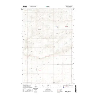
2017 Map of McBridy Spring
USGS Topo · Published 2017About this map
McBridy Spring sits at the center of this Montana landscape, where the high plains of Chouteau County are carved by intricate drainage systems. The terrain is defined by natural landmarks like Haystack Butte and the broad expanse of Sample Flat to the southeast. Water management is evident in the northwest with the White Elephant Reservoir, while the seasonal flow of the North Fork Dugout Coulee and Hay Stack Coulee illustrates the region's semi-arid character. A network of rural arteries, including Dent Bridge Rd and Ames Ranch Rd, connects isolated ranchlands. This survey provides a modern look at the land's topographical structure, from the sharp descent of Hells Gulch to the precisely surveyed boundaries of the Public Land Survey System townships, including t27n r4e and t27n r5e.
Find a feature on this map
19 named features on this map. Tap any name to fly to it.
Don’t see what you’re looking for? This feature index may not catch every label — zoom into the map to look around manually.
Map Details
Editions of this 2017 McBridy Spring Map
This is the sole edition of this map. No revisions or reprints were ever made.
Other maps of this area

1886 · Great Falls
USGS Topo · 1:250,000

1949 · Timber Coulee
USGS Topo · 1:62,500

1950 · Timber Coulee
USGS Topo · 1:62,500

1950 · Dent Bridge
USGS Topo · 1:62,500

1954 · Great Falls
USGS Topo · 1:250,000

1954 · Shelby
USGS Topo · 1:250,000

1957 · Great Falls
USGS Topo · 1:250,000

1958 · Shelby
USGS Topo · 1:250,000

1970 · Carlson Coulee
USGS Topo · 1:24,000

1970 · Knees NE
USGS Topo · 1:24,000