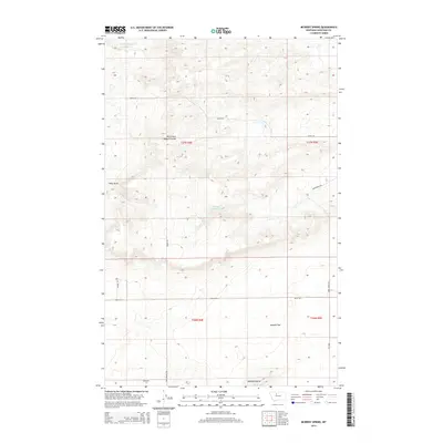
2014 Map of McBridy Spring
USGS Topo · Published 2014About this map
McBridy Spring sits at the center of this 2014 survey of the north-central Montana plains, illustrating a landscape defined by seasonal water and the vast ranching infrastructure of Chouteau County. The terrain is marked by significant topographical shifts, from the low-lying Sample Flat to the prominent rise of Haystack Butte in the southeast. Water management is critical in this arid environment, evidenced by the White Elephant Reservoir and the winding drainage of the North Fork Dugout Coulee. Local transportation routes, including Ames Ranch Rd and Dent Bridge Rd, follow the natural contours of the land, providing access to remote sections of the township grid. The presence of Hells Gulch and Tipi Rdg suggests a geography shaped by both erosion and local landmarks that serve as vital reference points for land management and history.
Find a feature on this map
18 named features on this map. Tap any name to fly to it.
Don’t see what you’re looking for? This feature index may not catch every label — zoom into the map to look around manually.
Map Details
Editions of this 2014 McBridy Spring Map
This is the sole edition of this map. No revisions or reprints were ever made.
Other maps of this area

1886 · Great Falls
USGS Topo · 1:250,000

1949 · Timber Coulee
USGS Topo · 1:62,500

1950 · Timber Coulee
USGS Topo · 1:62,500

1950 · Dent Bridge
USGS Topo · 1:62,500

1954 · Great Falls
USGS Topo · 1:250,000

1954 · Shelby
USGS Topo · 1:250,000

1957 · Great Falls
USGS Topo · 1:250,000

1958 · Shelby
USGS Topo · 1:250,000

1970 · Carlson Coulee
USGS Topo · 1:24,000

1970 · Knees NE
USGS Topo · 1:24,000