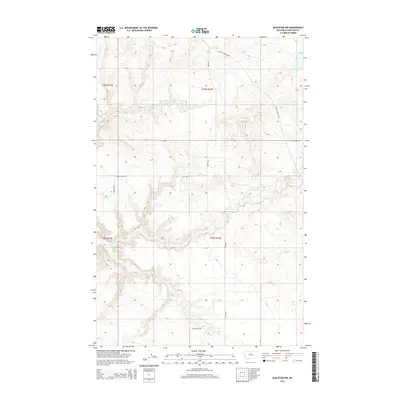
2014 Map of Eagleton NW
USGS Topo · Published 2014About this map
Eagle Cr carves a winding path through this portion of Chouteau County, creating a complex drainage system that defines the local topography. This 2014 survey by the U.S. Geological Survey illustrates a sparsely populated ranching landscape where movement is dictated by the ridgelines and coulees. Essential transport corridors such as Judith Landing Rd and Hopp Rd navigate the high ground, connecting remote parcels within the Public Land Survey System grids of t26n r14e and t25n r14e. The map captures the intersection of traditional land use and modern infrastructure, including several noted field stations or markers like FT 126 and FT 127. The arrangement of routes like Sheep Coulee Rd reflects the enduring reliance on the natural terrain to guide the development of this northern Montana territory.
Find a feature on this map
15 named features on this map. Tap any name to fly to it.
Don’t see what you’re looking for? This feature index may not catch every label — zoom into the map to look around manually.
Map Details
Editions of this 2014 Eagleton NW Map
This is the sole edition of this map. No revisions or reprints were ever made.
Other maps of this area

1890 · Fort Benton
USGS Topo · 1:250,000

1892 · Fort Benton
USGS Topo · 1:250,000

1897 · Fort Benton
USGS Topo · 1:250,000

1919 · Big Sandy
USGS Topo · 1:125,000

1953 · Eagle Buttes
USGS Topo · 1:24,000

1953 · Lonetree Coulee
USGS Topo · 1:24,000

1953 · Pilot Rock
USGS Topo · 1:24,000

1953 · Havre
USGS Topo · 1:250,000

1954 · Great Falls
USGS Topo · 1:250,000

1954 · Iliad
USGS Topo · 1:24,000