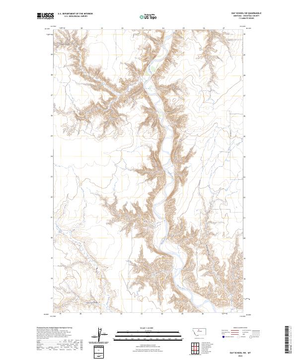
2024 Map of Day School SW
USGS Topo · Published 2024About this map
The Marias River carves a deep, winding path through the heart of this North Central Montana landscape, revealing the intricate drainage patterns of the northern Great Plains. This 2024 survey documents the rugged breaks and coulees that feed the river system, including Lone Tree Coulee and the uniquely named Slide Out Coulee. The terrain is characterized by steep elevation changes between the high prairie benches and the river valley floor.
Find a feature on this map
10 named features on this map. Tap any name to fly to it.
Don’t see what you’re looking for? This feature index may not catch every label — zoom into the map to look around manually.
Map Details
Editions of this 2024 Day School SW Map
This is the sole edition of this map. No revisions or reprints were ever made.
Other maps of this area

1890 · Fort Benton
USGS Topo · 1:250,000

1892 · Fort Benton
USGS Topo · 1:250,000

1897 · Fort Benton
USGS Topo · 1:250,000

1953 · Loma West
USGS Topo · 1:24,000

1954 · Great Falls
USGS Topo · 1:250,000

1954 · Shelby
USGS Topo · 1:250,000

1957 · Great Falls
USGS Topo · 1:250,000

1958 · Shelby
USGS Topo · 1:250,000
1964 · Fort Benton NW
USGS Topo · 1:24,000
1964 · Day School SW
USGS Topo · 1:24,000