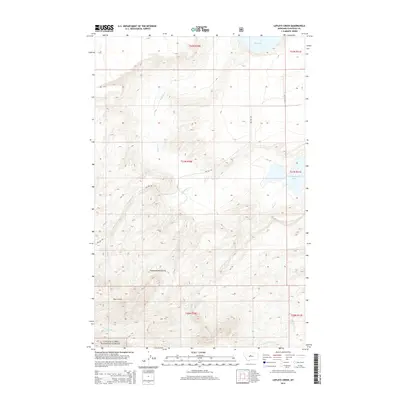
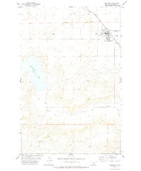
2014 Map of Lepleys Creek
USGS Topo · Published 2014About this map
The Highwood Mountains dominate this 2014 survey of north-central Montana, where the terrain shifts from the protected slopes of the Lewis & Clark National Forest to the ranchlands of Chouteau County. Steep drainage systems define the geography, with Bear Gulch and Postill Cr cutting through the southwestern heights. These waters eventually feed into broader basins, including Big Lake and Kingsbury Lake to the east and north.
Find a feature on this map
17 named features on this map. Tap any name to fly to it.
Don’t see what you’re looking for? This feature index may not catch every label — zoom into the map to look around manually.
Map Details
Editions of this 2014 Lepleys Creek Map
This is the sole edition of this map. No revisions or reprints were ever made.
Other maps of this area

1890 · Fort Benton
USGS Topo · 1:250,000

1892 · Fort Benton
USGS Topo · 1:250,000

1897 · Fort Benton
USGS Topo · 1:250,000

1954 · Great Falls
USGS Topo · 1:250,000

1957 · Great Falls
USGS Topo · 1:250,000
1972 · Montague
USGS Topo · 1:24,000
1972 · Shonkin
USGS Topo · 1:24,000
1972 · Geraldine NE
USGS Topo · 1:24,000

1978 · Arrow Peak
USGS Topo · 1:24,000
1978 · Geraldine
USGS Topo · 1:24,000