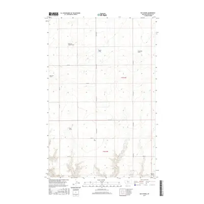
2017 Map of Day School
USGS Topo · Published 2017About this map
Day School serves as a central landmark in this high plains landscape of Chouteau County, where the topography is defined by an intricate network of drainage channels. The area is characterized by numerous seasonal waterways including West Fork Sixmile Coulee, Sixmile Coulee, and Twelvemile Coulee, which carve through the terrain of t27n r9e and t26n r9e. The map illustrates a disciplined grid of rural roads that facilitate movement across these coulees, connecting remote agricultural sites. Significant local routes such as Colony Bay Rd, Dry Fork Rd, and Jensen Rd provide the primary infrastructure for the region. The transition from the flat upland reaches into the deeper cuts of Fisher Coulee and Dry Fork Coulee reveals the subtle but persistent erosion patterns that define the drainage of this Montana territory.
Find a feature on this map
26 named features on this map. Tap any name to fly to it.
Don’t see what you’re looking for? This feature index may not catch every label — zoom into the map to look around manually.
Map Details
Editions of this 2017 Day School Map
This is the sole edition of this map. No revisions or reprints were ever made.
Other maps of this area

1890 · Fort Benton
USGS Topo · 1:250,000

1892 · Fort Benton
USGS Topo · 1:250,000

1897 · Fort Benton
USGS Topo · 1:250,000

1906 · Lonesome
USGS Topo · 1:62,500

1919 · Big Sandy
USGS Topo · 1:125,000

1953 · Loma East
USGS Topo · 1:24,000

1953 · Loma West
USGS Topo · 1:24,000

1954 · Great Falls
USGS Topo · 1:250,000

1954 · Shelby
USGS Topo · 1:250,000

1957 · Great Falls
USGS Topo · 1:250,000