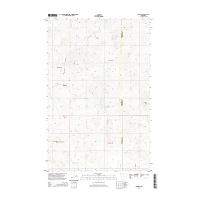
2014 Map of Warrick
USGS Topo · Published 2014About this map
Warrick sits as a primary point of reference in this high-plains landscape, where the Chouteau and Blaine county line divides the terrain. The map reveals a geography defined by its isolated peaks and seasonal water sources, featuring prominent landmarks like The Rock, Haystack Butte, and Rattlesnake Butte to the west, while Elkhorn Mtn rises in the east. The drainage network is complex, with Birch Cr and its various forks carving through the north, and Rhue Cr and Little Sand Cr feeding toward the south.
Find a feature on this map
29 named features on this map. Tap any name to fly to it.
Don’t see what you’re looking for? This feature index may not catch every label — zoom into the map to look around manually.
Map Details
Editions of this 2014 Warrick Map
This is the sole edition of this map. No revisions or reprints were ever made.
Other maps of this area

1953 · Havre
USGS Topo · 1:250,000

1954 · Lewistown
USGS Topo · 1:250,000

1956 · Maddux
USGS Topo · 1:62,500

1957 · Havre
USGS Topo · 1:250,000

1958 · Havre
USGS Topo · 1:250,000

1959 · Lewistown
USGS Topo · 1:250,000

1959 · Warrick
USGS Topo · 1:62,500
1984 · Eskay NE
USGS Topo · 1:24,000

1984 · Big John Butte
USGS Topo · 1:24,000
1984 · Warrick
USGS Topo · 1:24,000