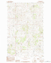
1984 Map of Warrick
USGS Topo · Published 1984About this map
Warrick sits at the heart of this high-plains landscape in North-Central Montana, where the drainages of the Bears Paw Mountains carve deep patterns into the terrain. The map captures a sophisticated network of seasonal and permanent water sources essential for ranching and settlement in this semi-arid region. Named water features like Blue Creek and Hatje Coulee define the local topography, while numerous isolated water points such as Polish Spring, Gasparage Spring, and Bills Spring suggest the vital importance of groundwater for early homesteaders and livestock in Chouteau County.
Find a feature on this map
20 named features on this map. Tap any name to fly to it.
Don’t see what you’re looking for? This feature index may not catch every label — zoom into the map to look around manually.
Map Details
Editions of this 1984 Warrick Map
This is the sole edition of this map. No revisions or reprints were ever made.
Other maps of this area

1953 · Havre
USGS Topo · 1:250,000

1954 · Lewistown
USGS Topo · 1:250,000

1956 · Maddux
USGS Topo · 1:62,500

1957 · Havre
USGS Topo · 1:250,000

1958 · Havre
USGS Topo · 1:250,000

1959 · Lewistown
USGS Topo · 1:250,000

1959 · Warrick
USGS Topo · 1:62,500
1984 · Eskay NE
USGS Topo · 1:24,000

1984 · Big John Butte
USGS Topo · 1:24,000
1984 · Bowery Peak
USGS Topo · 1:24,000