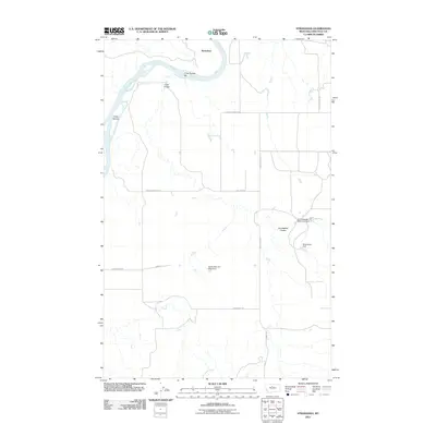
2011 Map of Stranahan
USGS Topo · Published 2011About this map
The Missouri River carves a winding path through this corner of Chouteau County, creating distinctive riparian features like Three Islands and Crow Coulee Bar. The terrain is defined by dry coulees and rural infrastructure, centered on the settlement of Stranahan. Land use in this part of Montana is reflected in the numerous small-scale water management projects scattered across the landscape, including the Homesteaders Settlement Dam, Blue Baron Dam, and the uniquely named Agnes Bob and Noel Dam. These structures, alongside routes like Virgelle Ferry Rd S and Loma Bridge Rd, indicate a landscape shaped by ranching and localized irrigation. The map provides a detailed view of the drainage patterns of Crow Coulee and Homestead Coulee as they intersect with a sparse network of county roads.
Find a feature on this map
15 named features on this map. Tap any name to fly to it.
Don’t see what you’re looking for? This feature index may not catch every label — zoom into the map to look around manually.
Map Details
Editions of this 2011 Stranahan Map
This is the sole edition of this map. No revisions or reprints were ever made.
Other maps of this area

1890 · Fort Benton
USGS Topo · 1:250,000

1892 · Fort Benton
USGS Topo · 1:250,000

1897 · Fort Benton
USGS Topo · 1:250,000

1919 · Big Sandy
USGS Topo · 1:125,000

1953 · Boggs Island
USGS Topo · 1:24,000

1953 · Rocky Lake
USGS Topo · 1:24,000

1953 · Loma East
USGS Topo · 1:24,000

1953 · Verona
USGS Topo · 1:24,000

1953 · Big Bend School
USGS Topo · 1:24,000

1953 · Stranahan
USGS Topo · 1:24,000