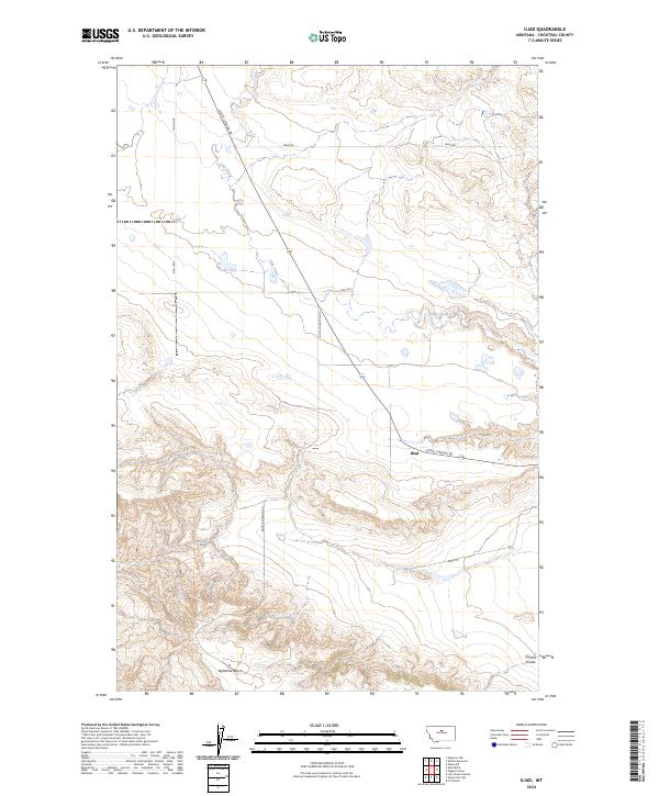
2024 Map of Iliad
USGS Topo · Published 2024About this map
Iliad serves as a focal point for this rural landscape in Chouteau County, where the plains of north-central Montana begin their descent toward the river. The topography is defined by significant landforms like Eightmile Bench and the drainages of Chip Creek and Clinard Coulee. A portion of the Upper Missouri River Breaks National Monument occupies the southwestern corner, preserving the distinctively eroded breaks that characterize this reach of the Missouri River valley. The road network, including Judith Landing Rd and Jappe Trl, reflects the long-standing ranching and transit patterns of the region, connecting isolated settlements to the historical river crossings that once served as vital trade arteries for the Montana territory.
Find a feature on this map
16 named features on this map. Tap any name to fly to it.
Don’t see what you’re looking for? This feature index may not catch every label — zoom into the map to look around manually.
Map Details
Editions of this 2024 Iliad Map
This is the sole edition of this map. No revisions or reprints were ever made.
Other maps of this area

1953 · Starve Out Flat
USGS Topo · 1:24,000

1953 · Last Chance Bench
USGS Topo · 1:24,000

1954 · P N Ranch
USGS Topo · 1:24,000

1954 · Iliad
USGS Topo · 1:24,000

1954 · Dark Butte
USGS Topo · 1:24,000

1954 · Lewistown
USGS Topo · 1:250,000

1959 · Lewistown
USGS Topo · 1:250,000

1964 · Pigtail Coulee
USGS Topo · 1:24,000
1984 · Seifort Reservoir
USGS Topo · 1:24,000
1984 · Eskay NW
USGS Topo · 1:24,000