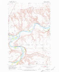
1953 Map of Loma East
USGS Topo · Published 1977About this map
The confluence of the Marias River and the Missouri River anchors this mid-century survey of Chouteau County. The landscape is defined by the sharp transition between the alluvial bottomlands and the elevated plains of Rowe Bench. Near the settlement of Loma, the river system creates complex terrain features like Archers Island and Churchill Bend, while the Great Northern railroad tracks follow the water's path through the valley. This era reveals a river-oriented economy before modern bridges superseded the old crossings, as evidenced by the Loma Ferry near the mouth of the Marias. Farther east, the West Wayside School and several windmills indicate the sparse but established ranching and farming community occupying the higher ground above the Black Bluffs.
Find a feature on this map
20 named features on this map. Tap any name to fly to it.
Don’t see what you’re looking for? This feature index may not catch every label — zoom into the map to look around manually.
Map Details
Editions of this 1953 Loma East Map
2 editions found
Other maps of this area

1890 · Fort Benton
USGS Topo · 1:250,000

1892 · Fort Benton
USGS Topo · 1:250,000

1897 · Fort Benton
USGS Topo · 1:250,000

1919 · Big Sandy
USGS Topo · 1:125,000

1953 · Boggs Island
USGS Topo · 1:24,000

1953 · Rocky Lake
USGS Topo · 1:24,000

1953 · Loma East
USGS Topo · 1:24,000

1953 · O'Hanlon Coulee
USGS Topo · 1:24,000

1953 · Loma West
USGS Topo · 1:24,000

1953 · Stranahan
USGS Topo · 1:24,000