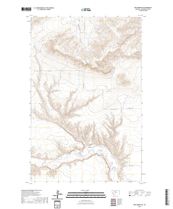
2024 Map of Dent Bridge NE
USGS Topo · Published 2024About this map
High plains topography and deep drainage channels characterize this portion of Chouteau County, where the landscape is defined by the Teton River and its various coulees. The terrain is segmented by a sparse grid of rural passages such as Beaverslide Rd and Collins Rd, which navigate the elevation changes between the upland flats and the winding river valley. To the north, the land is carved by Dugout Coulee and Dry Fork Coulee, features that demonstrate the characteristic erosion patterns of the Montana prairie. This 2024 data reflects the contemporary persistence of the Public Land Survey System, with township boundaries like t26n r5e and t25n r6e organizing the vast agricultural and grazing tracts. The map provides a clear look at the local road network, including Dutch Ed Rd and Buck Bridge Rd, essential for navigating this sparsely populated region.
Find a feature on this map
10 named features on this map. Tap any name to fly to it.
Don’t see what you’re looking for? This feature index may not catch every label — zoom into the map to look around manually.
Map Details
Editions of this 2024 Dent Bridge NE Map
This is the sole edition of this map. No revisions or reprints were ever made.
Other maps of this area

1886 · Great Falls
USGS Topo · 1:250,000

1890 · Fort Benton
USGS Topo · 1:250,000

1892 · Fort Benton
USGS Topo · 1:250,000

1897 · Fort Benton
USGS Topo · 1:250,000

1950 · Dent Bridge
USGS Topo · 1:62,500

1953 · Carter
USGS Topo · 1:24,000

1954 · Great Falls
USGS Topo · 1:250,000

1954 · Shelby
USGS Topo · 1:250,000

1957 · Great Falls
USGS Topo · 1:250,000

1958 · Shelby
USGS Topo · 1:250,000