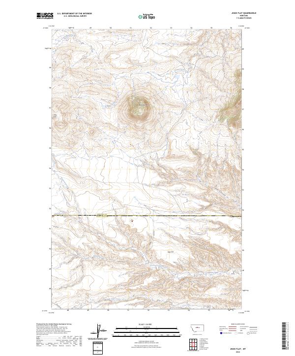
2024 Map of Jiggs Flat
USGS Topo · Published 2024About this map
Round Butte serves as the central landmark for this portion of the Montana prairie, rising above a landscape defined by seasonal drainages and wide upland benches. The map details the border between Chouteau and Judith Basin counties, where the terrain transitions from the elevated Libby Hills toward the broad expanse of Jiggs Flat. This area is characterized by a network of vital watercourses that supported early ranching and homesteading efforts, including Cottonwood Creek, Cowboy Creek, and Fall Creek.
Find a feature on this map
18 named features on this map. Tap any name to fly to it.
Don’t see what you’re looking for? This feature index may not catch every label — zoom into the map to look around manually.
Map Details
Editions of this 2024 Jiggs Flat Map
This is the sole edition of this map. No revisions or reprints were ever made.
Other maps of this area

1890 · Fort Benton
USGS Topo · 1:250,000

1892 · Fort Benton
USGS Topo · 1:250,000

1897 · Fort Benton
USGS Topo · 1:250,000

1954 · Great Falls
USGS Topo · 1:250,000

1957 · Great Falls
USGS Topo · 1:250,000

1972 · Square Butte
USGS Topo · 1:24,000

1978 · Leiberg Coulee
USGS Topo · 1:24,000
1978 · Geraldine
USGS Topo · 1:24,000
1979 · Palisade Butte
USGS Topo · 1:24,000
1979 · Jiggs Flat
USGS Topo · 1:24,000