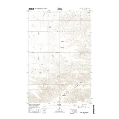
2017 Map of Steele Lake Coulee
USGS Topo · Published 2017About this map
Steele Lake Coulee and the winding boundary between Chouteau Co and Fergus Co define this high-plains landscape in central Montana. The terrain is characterized by a series of significant drainage features cutting through the elevation, including Fahlgren Coulee, Wilson Coulee, and Engellant Coulee. To the south, the topography transitions toward the Arrow Creek Bench, providing a clear view of the complex erosion patterns common to this part of the Missouri River watershed.
Find a feature on this map
21 named features on this map. Tap any name to fly to it.
Don’t see what you’re looking for? This feature index may not catch every label — zoom into the map to look around manually.
Map Details
Editions of this 2017 Steele Lake Coulee Map
This is the sole edition of this map. No revisions or reprints were ever made.
Other maps of this area

1890 · Fort Benton
USGS Topo · 1:250,000

1892 · Fort Benton
USGS Topo · 1:250,000

1897 · Fort Benton
USGS Topo · 1:250,000

1953 · Starve Out Flat
USGS Topo · 1:24,000

1953 · Last Chance Bench
USGS Topo · 1:24,000

1954 · Great Falls
USGS Topo · 1:250,000

1954 · Lewistown
USGS Topo · 1:250,000

1957 · Great Falls
USGS Topo · 1:250,000

1959 · Lewistown
USGS Topo · 1:250,000

1964 · Spring Coulee
USGS Topo · 1:24,000