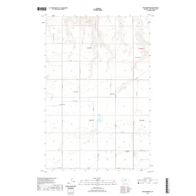
2020 Map of Rice Reservoir
USGS Topo · Published 2020About this map
Rice Reservoir and the surrounding Chouteau County landscape are defined by a network of drainage channels and agricultural infrastructure. This part of Montana exhibits a series of distinctive coulees—dry stream beds that carve into the terrain—including the prominent Long Coulee and Cherry Coulee. Water management is central to the area's utility, represented by Rice Reservoir and Birkeland Reservoir, which collect seasonal runoff for local use. The road system, with names like Wheat Land Rd and Stage Line Rd, suggests a long history of grain transport and early travel routes. The land is surveyed under the Public Land Survey System, as indicated by the township and range lines for t22n r7e and t23n r8e, illustrating the geometric organization of this rural prairie environment in the 21st century.
Find a feature on this map
23 named features on this map. Tap any name to fly to it.
Don’t see what you’re looking for? This feature index may not catch every label — zoom into the map to look around manually.
Map Details
Editions of this 2020 Rice Reservoir Map
This is the sole edition of this map. No revisions or reprints were ever made.
Other maps of this area

1890 · Fort Benton
USGS Topo · 1:250,000

1892 · Fort Benton
USGS Topo · 1:250,000

1897 · Fort Benton
USGS Topo · 1:250,000

1953 · Carter
USGS Topo · 1:24,000

1953 · Tunis
USGS Topo · 1:24,000

1954 · Great Falls
USGS Topo · 1:250,000

1954 · Rice Reservoir
USGS Topo · 1:24,000

1954 · Fort Benton
USGS Topo · 1:24,000

1954 · Lander Crossing
USGS Topo · 1:24,000

1954 · Waltham
USGS Topo · 1:24,000