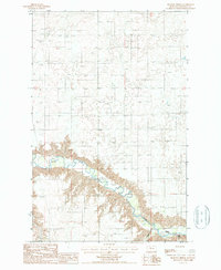
1987 Map of Shannon Bridge
USGS Topo · Published 1987About this map
The Teton River carves a deep path through the plateau of Chouteau County in this 1987 provisional survey, revealing a landscape defined by sharp coulees and remote ranching infrastructure. The river valley is flanked by Sheep Coulee and Wolf Coulee, which cut into the high plains of Antelope Flat. This era shows the persistence of early 20th-century landmarks such as the Faris School and Mc Bridy Spring, alongside modern utility developments like the Pumping Station and an extensive Pipeline network. The map records several vital river crossings, including Woods Crossing and Dent Bridge, which served as critical nodes for local transit across the winding waterway. These features, combined with isolated markers like a lone Grave, offer a granular look at the sparse settlement patterns and utilitarian land use in North Central Montana during the late 1980s.
Find a feature on this map
15 named features on this map. Tap any name to fly to it.
Don’t see what you’re looking for? This feature index may not catch every label — zoom into the map to look around manually.
Map Details
Editions of this 1987 Shannon Bridge Map
This is the sole edition of this map. No revisions or reprints were ever made.
Other maps of this area

1886 · Great Falls
USGS Topo · 1:250,000

1949 · Timber Coulee
USGS Topo · 1:62,500

1950 · Timber Coulee
USGS Topo · 1:62,500

1950 · Dent Bridge
USGS Topo · 1:62,500

1954 · Great Falls
USGS Topo · 1:250,000

1954 · Shelby
USGS Topo · 1:250,000

1957 · Great Falls
USGS Topo · 1:250,000

1958 · Shelby
USGS Topo · 1:250,000
1965 · Sheep Coulee Spring
USGS Topo · 1:24,000

1970 · Knees
USGS Topo · 1:24,000