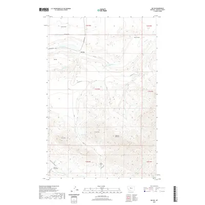
2020 Map of Big Sag
USGS Topo · Published 2020About this map
The Highwood Mountains dominate the southern half of this landscape, rising to prominent peaks like Gossack Mtn and Harris Mtn. This high-altitude terrain is carved by a complex network of drainages, including Keaster Cr, N Gap Cr, and S Gap Cr, which flow northward toward the lower plains. In the valley below, the Upper Highwood Cem sits near the headwaters of Highwood Cr, offering a point of interest for those tracing family history in Chouteau County.
Find a feature on this map
34 named features on this map. Tap any name to fly to it.
Don’t see what you’re looking for? This feature index may not catch every label — zoom into the map to look around manually.
Map Details
Editions of this 2020 Big Sag Map
This is the sole edition of this map. No revisions or reprints were ever made.
Other maps of this area

1890 · Fort Benton
USGS Topo · 1:250,000

1892 · Fort Benton
USGS Topo · 1:250,000

1897 · Fort Benton
USGS Topo · 1:250,000

1954 · Great Falls
USGS Topo · 1:250,000

1954 · Rice Reservoir
USGS Topo · 1:24,000

1956 · Highwood
USGS Topo · 1:62,500

1956 · Belt
USGS Topo · 1:62,500

1957 · Great Falls
USGS Topo · 1:250,000
1972 · Shonkin NW
USGS Topo · 1:24,000
1972 · Shonkin
USGS Topo · 1:24,000