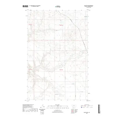
2020 Map of Eagleton NW
USGS Topo · Published 2020About this map
Eagle Cr and the branching drainages of Sheep Coulee define this high prairie landscape in Chouteau County. The map reflects a remote ranching and agricultural region where travel is guided by long gravel routes like Judith Landing Rd and Hopp Rd. At the heart of the northern section is the site known as Butler, while the southern reaches are marked by the intersection of Five Corner Rd and W Five Corner Rd. This area, surveyed for the National Geospatial Program, demonstrates the enduring grid of the Public Land Survey System, with township and range lines like t25n r14e providing a framework for the sparsely settled terrain. The proximity of Eagle Butte Rd suggests the local importance of the nearby landforms in navigating this open country.
Find a feature on this map
13 named features on this map. Tap any name to fly to it.
Don’t see what you’re looking for? This feature index may not catch every label — zoom into the map to look around manually.
Map Details
Editions of this 2020 Eagleton NW Map
This is the sole edition of this map. No revisions or reprints were ever made.
Other maps of this area

1890 · Fort Benton
USGS Topo · 1:250,000

1892 · Fort Benton
USGS Topo · 1:250,000

1897 · Fort Benton
USGS Topo · 1:250,000

1919 · Big Sandy
USGS Topo · 1:125,000

1953 · Eagle Buttes
USGS Topo · 1:24,000

1953 · Lonetree Coulee
USGS Topo · 1:24,000

1953 · Pilot Rock
USGS Topo · 1:24,000

1953 · Havre
USGS Topo · 1:250,000

1954 · Great Falls
USGS Topo · 1:250,000

1954 · Iliad
USGS Topo · 1:24,000