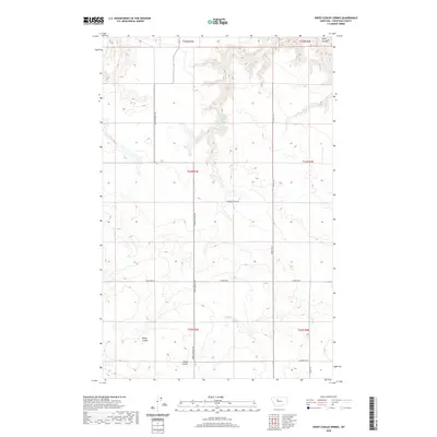
2020 Map of Sheep Coulee Spring
USGS Topo · Published 2020About this map
Sheep Coulee Spring remains a vital water point in this high-plains landscape of northern Chouteau County. The terrain is defined by a network of drainage channels, including Wolf Coulee, Alkali Coulee, and the namesake Sheep Coulee, which cut through the surrounding tablelands. This 2020 map documents the modern road network that traces much older corridors, most notably the north-south passage of the Bootlegger Trl. These routes, along with evocatively named paths like Promised Land Rd and Woods Xing S, highlight the enduring grid of agricultural and transport lines in rural Montana. The map illustrates how section lines and county roads such as Carter Rd W and Floweree Rd W structure the vast open spaces of the T24N and T25N townships.
Find a feature on this map
19 named features on this map. Tap any name to fly to it.
Don’t see what you’re looking for? This feature index may not catch every label — zoom into the map to look around manually.
Map Details
Editions of this 2020 Sheep Coulee Spring Map
This is the sole edition of this map. No revisions or reprints were ever made.
Other maps of this area

1886 · Great Falls
USGS Topo · 1:250,000

1948 · Portage
USGS Topo · 1:62,500

1949 · Portage
USGS Topo · 1:62,500

1949 · Timber Coulee
USGS Topo · 1:62,500

1949 · Great Falls
USGS Topo · 1:62,500

1950 · Timber Coulee
USGS Topo · 1:62,500

1950 · Dent Bridge
USGS Topo · 1:62,500

1951 · Great Falls
USGS Topo · 1:62,500

1954 · Great Falls
USGS Topo · 1:250,000

1957 · Great Falls
USGS Topo · 1:250,000