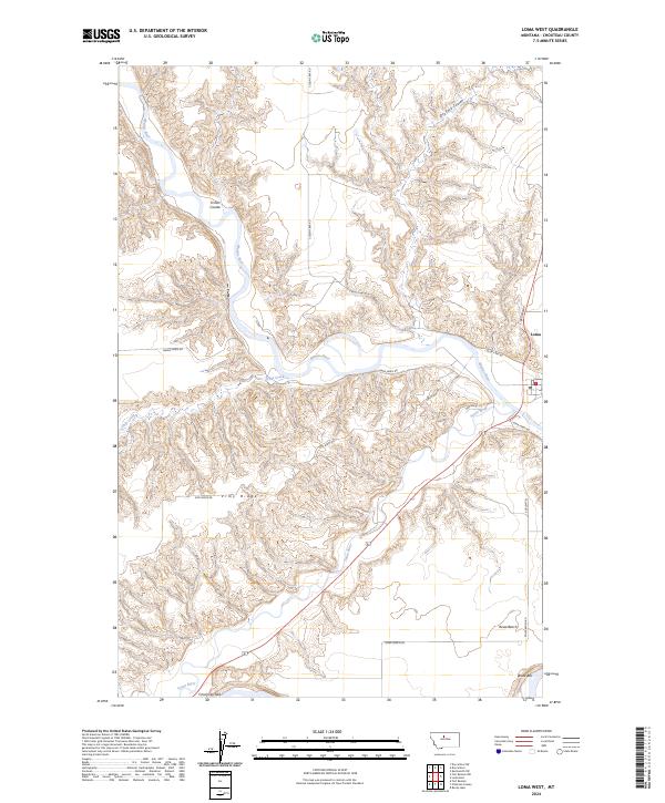
2024 Map of Loma West
USGS Topo · Published 2024About this map
The confluence of the Marias River and the Teton River anchors this central Montana landscape, where the settlement of Loma sits at a critical geographic junction. The terrain is defined by dramatic breaks and coulees, including Fisher Coulee and Dry Fork Coulee, which carve through the high plains of Rowe Bench. To the south, a portion of the Upper Missouri River Breaks National Monument preserves the character of the Missouri Wild and Scenic River corridor. Local transit is marked by paths like Loma Ferry Rd and Vimy Ridge Rd, tracing routes over landforms like Vimy Ridge and the distinctively named Crocon du Nez. The map illustrates the persistent relationship between the river valley's hydrology and the surrounding plateau, providing a clear view of the area's modern-day rural infrastructure and protected natural spaces.
Find a feature on this map
25 named features on this map. Tap any name to fly to it.
Don’t see what you’re looking for? This feature index may not catch every label — zoom into the map to look around manually.
Map Details
Editions of this 2024 Loma West Map
This is the sole edition of this map. No revisions or reprints were ever made.
Other maps of this area

1890 · Fort Benton
USGS Topo · 1:250,000

1892 · Fort Benton
USGS Topo · 1:250,000

1897 · Fort Benton
USGS Topo · 1:250,000

1919 · Big Sandy
USGS Topo · 1:125,000

1953 · Rocky Lake
USGS Topo · 1:24,000

1953 · Loma East
USGS Topo · 1:24,000

1953 · O'Hanlon Coulee
USGS Topo · 1:24,000

1953 · Loma West
USGS Topo · 1:24,000

1954 · Great Falls
USGS Topo · 1:250,000

1954 · Fort Benton
USGS Topo · 1:24,000