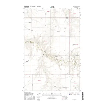
2017 Map of Waltham
USGS Topo · Published 2017About this map
Belt Creek carves a winding path through the center of this landscape, creating a series of dramatic bends that necessitated complex engineering for transit. The presence of numbered structures such as Lacey Tunnel Number 3, Amphitheater Tunnel Number 4, and Belt Creek Tunnel Number 5 indicates a significant rail or road corridor following the river's descent. Settlement is concentrated at the small community of Waltham and the locality of Rogers, while the surrounding terrain is defined by distinctive coulees and heights like Shepherd Butte and Rattlesnake Hill. The map also documents local aviation infrastructure with the Peterson Ranch Airport situated near Highwood Creek. This 2017 survey details the intersection of Chouteau and Cascade counties, showing how modern transportation routes like Waltham Road and Highwood Road navigate the area's deep drainages and ridges.
Find a feature on this map
38 named features on this map. Tap any name to fly to it.
Don’t see what you’re looking for? This feature index may not catch every label — zoom into the map to look around manually.
Map Details
Editions of this 2017 Waltham Map
This is the sole edition of this map. No revisions or reprints were ever made.
Other maps of this area

1886 · Great Falls
USGS Topo · 1:250,000

1890 · Fort Benton
USGS Topo · 1:250,000

1892 · Fort Benton
USGS Topo · 1:250,000

1897 · Fort Benton
USGS Topo · 1:250,000

1948 · Portage
USGS Topo · 1:62,500

1949 · Portage
USGS Topo · 1:62,500

1954 · Great Falls
USGS Topo · 1:250,000

1954 · Rice Reservoir
USGS Topo · 1:24,000

1954 · Lander Crossing
USGS Topo · 1:24,000

1954 · Waltham
USGS Topo · 1:24,000