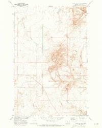
1970 Map of Goose Bill Butte
USGS Topo · Published 1973About this map
Goose Bill Butte rises as the central topographic focal point of this northern Montana landscape, located in Chouteau County. The 1970 field survey captures a region defined by its complex drainage systems and coulees, reflecting the Missouri River Basin’s natural erosion patterns. This territory is marked by the presence of intermittent watercourses including Dead Indian Coulee and Goose Bill Coulee, which snake through the high plains. The map's detailed contour lines illustrate the sharp elevation changes of the butte and the surrounding draws, such as Hellgate Coulee and Slide Out Coulee. This is a portrait of the Big Sky country at a time when the Department of the Interior was focused on the systematic development and mapping of the Missouri River Basin's rural reaches.
Find a feature on this map
8 named features on this map. Tap any name to fly to it.
Don’t see what you’re looking for? This feature index may not catch every label — zoom into the map to look around manually.
Map Details
Editions of this 1970 Goose Bill Butte Map
This is the sole edition of this map. No revisions or reprints were ever made.
Other maps of this area

1890 · Fort Benton
USGS Topo · 1:250,000

1892 · Fort Benton
USGS Topo · 1:250,000

1897 · Fort Benton
USGS Topo · 1:250,000

1954 · Great Falls
USGS Topo · 1:250,000

1954 · Shelby
USGS Topo · 1:250,000

1957 · Great Falls
USGS Topo · 1:250,000

1958 · Shelby
USGS Topo · 1:250,000
1964 · Fort Benton NW
USGS Topo · 1:24,000
1964 · Day School SW
USGS Topo · 1:24,000

1969 · Dutch Henry Coulee
USGS Topo · 1:24,000