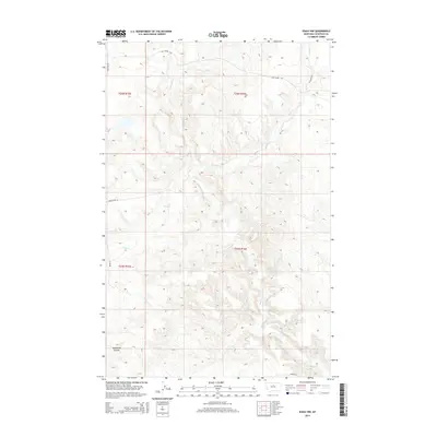
2014 Map of Eskay NW
USGS Topo · Published 2014About this map
Birch Creek and its tributaries define the drainage patterns across this section of Chouteau County, where the high plains are carved by deep seasonal watercourses. The landscape is marked by the distinctive Sandstone Coulee in the southwest, reflecting the erosive geology of the Missouri River breaks region. Transportation in this part of Montana follows both historical and modern lines, with the Cow Island Trail cutting through the northern townships. This trail represents a significant historical freighting route that once connected the Missouri River to interior settlements. The map also documents the network of local ranch roads, such as Eagleton Road and Brewer Road, which provide access to the dispersed agricultural and ranching holdings that characterize the modern land use within these sections.
Find a feature on this map
14 named features on this map. Tap any name to fly to it.
Don’t see what you’re looking for? This feature index may not catch every label — zoom into the map to look around manually.
Map Details
Editions of this 2014 Eskay NW Map
This is the sole edition of this map. No revisions or reprints were ever made.
Other maps of this area

1953 · Havre
USGS Topo · 1:250,000

1954 · Iliad
USGS Topo · 1:24,000

1954 · Lewistown
USGS Topo · 1:250,000

1957 · Havre
USGS Topo · 1:250,000

1958 · Havre
USGS Topo · 1:250,000

1959 · Lewistown
USGS Topo · 1:250,000

1959 · Warrick
USGS Topo · 1:62,500

1959 · Centennial Mountain
USGS Topo · 1:62,500

1964 · Pigtail Coulee
USGS Topo · 1:24,000

1964 · Chase Hill
USGS Topo · 1:24,000