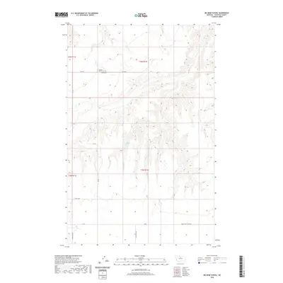
2020 Map of Big Bend School
USGS Topo · Published 2020About this map
Big Bend School (historical) stands as a primary point of interest in this section of Chouteau County, where the landscape is defined by the high plains of central Montana. The presence of McCullen Spring provides a rare water source in this arid environment, which is marked by a network of rural roads such as Fultz Dr and Big Bend Rd. The infrastructure suggests a history of dryland farming and ranching, with the Eagle Butte School Rd and Pump Station Rd hinting at the essential services required for isolated agricultural communities. A distinctive circular road pattern at Alkali Loop reflects the local terrain and the practicalities of navigating this expansive territory north of Geraldine.
Find a feature on this map
14 named features on this map. Tap any name to fly to it.
Don’t see what you’re looking for? This feature index may not catch every label — zoom into the map to look around manually.
Map Details
Editions of this 2020 Big Bend School Map
This is the sole edition of this map. No revisions or reprints were ever made.
Other maps of this area

1890 · Fort Benton
USGS Topo · 1:250,000

1892 · Fort Benton
USGS Topo · 1:250,000

1897 · Fort Benton
USGS Topo · 1:250,000

1919 · Big Sandy
USGS Topo · 1:125,000

1953 · Boggs Island
USGS Topo · 1:24,000

1953 · Eagle Buttes
USGS Topo · 1:24,000

1953 · Verona
USGS Topo · 1:24,000

1953 · Big Bend School
USGS Topo · 1:24,000

1953 · Lonetree Coulee
USGS Topo · 1:24,000

1953 · Pilot Rock
USGS Topo · 1:24,000