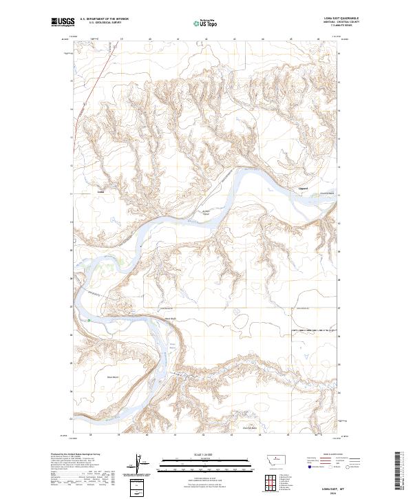
2024 Map of Loma East
USGS Topo · Published 2024About this map
The confluence of the Missouri River and Marias River anchors this Chouteau County landscape, where the expansive Upper Missouri River Breaks National Monument preserves a complex riverine environment. The settlement of Loma sits near the western edge, connected by local routes such as Loma Ferry Rd and Great Northern Rd. Topographical features like Rowe Bench and Rowe Coulee indicate the significant elevation changes typical of the river breaks, while the Missouri Wild and Scenic River designation highlights the area's protected character.
Find a feature on this map
21 named features on this map. Tap any name to fly to it.
Don’t see what you’re looking for? This feature index may not catch every label — zoom into the map to look around manually.
Map Details
Editions of this 2024 Loma East Map
This is the sole edition of this map. No revisions or reprints were ever made.
Other maps of this area

1890 · Fort Benton
USGS Topo · 1:250,000

1892 · Fort Benton
USGS Topo · 1:250,000

1897 · Fort Benton
USGS Topo · 1:250,000

1919 · Big Sandy
USGS Topo · 1:125,000

1953 · Boggs Island
USGS Topo · 1:24,000

1953 · Rocky Lake
USGS Topo · 1:24,000

1953 · Loma East
USGS Topo · 1:24,000

1953 · O'Hanlon Coulee
USGS Topo · 1:24,000

1953 · Loma West
USGS Topo · 1:24,000

1953 · Stranahan
USGS Topo · 1:24,000