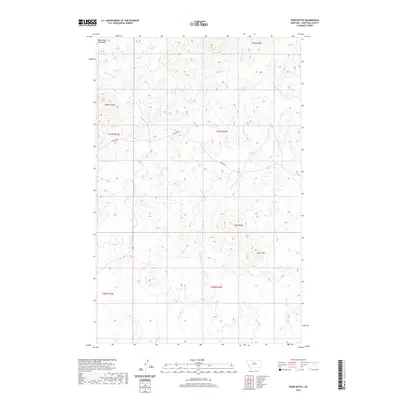
2020 Map of Tiger Butte
USGS Topo · Published 2020About this map
Bears Paw Mountains define the northern reaches of this section of Chouteau County, where high ridges and creek beds create a distinct drainage pattern. The landscape is anchored by prominent landforms such as Tiger Butte and Tiger Ridge in the southeast, while Sawmill Butte and Pecora Ridge dominate the western and northeastern horizons. This terrain dictates the flow of numerous seasonal watercourses, including Eagle Cr and Dog Cr, which weave through the valleys between these elevations.
Find a feature on this map
15 named features on this map. Tap any name to fly to it.
Don’t see what you’re looking for? This feature index may not catch every label — zoom into the map to look around manually.
Map Details
Editions of this 2020 Tiger Butte Map
This is the sole edition of this map. No revisions or reprints were ever made.
Other maps of this area

1953 · Havre
USGS Topo · 1:250,000

1954 · Lewistown
USGS Topo · 1:250,000

1957 · Havre
USGS Topo · 1:250,000

1958 · Havre
USGS Topo · 1:250,000

1959 · Lewistown
USGS Topo · 1:250,000
1959 · Warrick
USGS Topo · 1:62,500
1959 · Centennial Mountain
USGS Topo · 1:62,500
1984 · Eskay NE
USGS Topo · 1:24,000
1984 · Big John Butte
USGS Topo · 1:24,000
1984 · Warrick
USGS Topo · 1:24,000