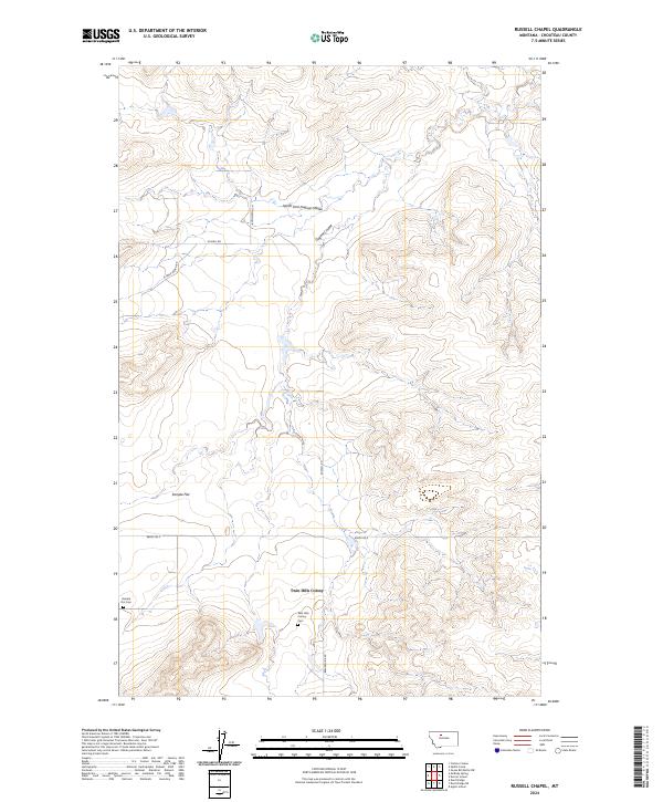
2024 Map of Russell Chapel
USGS Topo · Published 2024About this map
Twin Hills Colony serves as a modern agricultural anchor in this central Montana landscape, situated near the headwaters of the Dugout Coulee. The topography is defined by the broad expanse of Sample Flat and the intricate drainage of North Fork Dugout Coulee, illustrating the persistent reliance on natural waterways and landform-dictated settlement in Chouteau County.
Find a feature on this map
15 named features on this map. Tap any name to fly to it.
Don’t see what you’re looking for? This feature index may not catch every label — zoom into the map to look around manually.
Map Details
Editions of this 2024 Russell Chapel Map
This is the sole edition of this map. No revisions or reprints were ever made.
Other maps of this area

1886 · Great Falls
USGS Topo · 1:250,000

1890 · Fort Benton
USGS Topo · 1:250,000

1892 · Fort Benton
USGS Topo · 1:250,000

1897 · Fort Benton
USGS Topo · 1:250,000

1950 · Dent Bridge
USGS Topo · 1:62,500

1954 · Great Falls
USGS Topo · 1:250,000

1954 · Shelby
USGS Topo · 1:250,000

1957 · Great Falls
USGS Topo · 1:250,000

1958 · Shelby
USGS Topo · 1:250,000

1970 · Carlson Coulee
USGS Topo · 1:24,000