
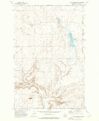
1972 Map of Square Butte SE
USGS Topo · Published 1976About this map
Square Butte Bench dominates this high-plains landscape in Chouteau County, where 1970s land use reflects a mix of dryland agriculture and aviation infrastructure. The map reveals a community centered around the Square Butte Bench Cem and the nearby Community Building, appearing alongside Hawarden Hall. The terrain is deeply etched by a network of drainage features including Phantom Coulee, Bank Coulee, and Big Coulee, which cut through the level benchland. The presence of multiple Landing Strip sites and various Landing Strips suggests the importance of light aircraft for managing this expansive Montana territory. These agricultural markers, including scattered Storage Bins and a Flowing Well, document the rural economy as it functioned shortly after the 1971 aerial photogrammetric survey.
Find a feature on this map
13 named features on this map. Tap any name to fly to it.
Don’t see what you’re looking for? This feature index may not catch every label — zoom into the map to look around manually.
Map Details
Editions of this 1972 Square Butte SE Map
This is the sole edition of this map. No revisions or reprints were ever made.
Other maps of this area

1890 · Fort Benton
USGS Topo · 1:250,000

1892 · Fort Benton
USGS Topo · 1:250,000

1897 · Fort Benton
USGS Topo · 1:250,000

1953 · Last Chance Bench
USGS Topo · 1:24,000

1954 · Great Falls
USGS Topo · 1:250,000

1954 · Lewistown
USGS Topo · 1:250,000

1957 · Great Falls
USGS Topo · 1:250,000

1959 · Lewistown
USGS Topo · 1:250,000

1972 · Square Butte
USGS Topo · 1:24,000
1972 · Dammel Reservoir
USGS Topo · 1:24,000