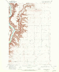
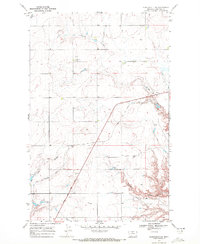
1969 Map of Discovery Butte
USGS Topo · Published 1972About this map
The Marias River carves a deeply eroded valley along the western edge of this 1969 landscape, where the high plains of Chouteau County break into complex breaks and coulees. The terrain is defined by prominent high points including Black Butte and the namesake Discovery Butte in the southwest corner. Human activity in this rural expanse is sparse, marked primarily by the Bessette Ranch and several remote Landing Strips that suggest the necessity of light aircraft for navigating these isolated grazing lands. Extensive coulee systems such as O'Halon Coulee and Sixmile Coulee drain the eastern plateau, illustrating the dramatic transition from flat upland benches to the rugged river breaks. This survey captures a moment in the late 1960s when the region remained a domain of wide-open ranching operations and natural landforms.
Find a feature on this map
13 named features on this map. Tap any name to fly to it.
Don’t see what you’re looking for? This feature index may not catch every label — zoom into the map to look around manually.
Map Details
Editions of this 1969 Discovery Butte Map
This is the sole edition of this map. No revisions or reprints were ever made.
Other maps of this area

1906 · Lonesome
USGS Topo · 1:62,500

1919 · Big Sandy
USGS Topo · 1:125,000

1954 · Shelby
USGS Topo · 1:250,000

1958 · Shelby
USGS Topo · 1:250,000
1964 · Day School SW
USGS Topo · 1:24,000
1964 · Day School
USGS Topo · 1:24,000

1969 · Fourteenmile Coulee SW
USGS Topo · 1:24,000
1969 · Kenilworth
USGS Topo · 1:24,000

1969 · Dutch Henry Coulee
USGS Topo · 1:24,000
1969 · Kenilworth SW
USGS Topo · 1:24,000