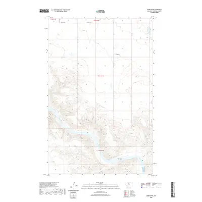
2020 Map of Dark Butte
USGS Topo · Published 2020About this map
The Missouri River carves a deep, winding path through the southern half of this landscape in Chouteau County, creating a dramatic topographical contrast between the high prairie benches and the riparian bottomlands. This 2020 record of the region highlights the isolated nature of the terrain, where large land blocks are defined by the Public Land Survey System, such as t24n r14e and t23n r14e. Within the river's channel, Pablo Island stands as a prominent feature, shaped by the shifting currents of the Missouri.
Find a feature on this map
11 named features on this map. Tap any name to fly to it.
Don’t see what you’re looking for? This feature index may not catch every label — zoom into the map to look around manually.
Map Details
Editions of this 2020 Dark Butte Map
This is the sole edition of this map. No revisions or reprints were ever made.
Other maps of this area

1890 · Fort Benton
USGS Topo · 1:250,000

1892 · Fort Benton
USGS Topo · 1:250,000

1897 · Fort Benton
USGS Topo · 1:250,000

1953 · Starve Out Flat
USGS Topo · 1:24,000

1953 · Eagle Buttes
USGS Topo · 1:24,000

1953 · Last Chance Bench
USGS Topo · 1:24,000

1953 · Pilot Rock
USGS Topo · 1:24,000

1954 · Great Falls
USGS Topo · 1:250,000

1954 · Iliad
USGS Topo · 1:24,000

1954 · Dark Butte
USGS Topo · 1:24,000