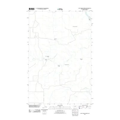
2011 Map of Last Chance Bench
USGS Topo · Published 2011About this map
The Missouri River cuts through the northeastern corner of this Chouteau County landscape, creating Wolf Island at a sharp bend in the waterway. The geography is defined by the high plateau of Last Chance Bench and the prominent Wild Horse Butte, indicating a terrain heavily shaped by erosion and drainage into the river system. A network of deep ravines and coulees, including Antelope Coulee, Spring Coulee, and Tom Dale Coulee, carve through the region, illustrating the complex hydrology of the Missouri River basin. Rural connectivity is maintained through several established routes such as Graceville Rd, Hopkins Hill Rd, and Range Rd, which navigate the elevation changes near Flat Creek Pass. This area of central Montana represents a classic big-sky landscape where cattle ranching and dryland farming are dictated by the presence of vital water sources like Flat Creek and Liberty Spring.
Find a feature on this map
14 named features on this map. Tap any name to fly to it.
Don’t see what you’re looking for? This feature index may not catch every label — zoom into the map to look around manually.
Map Details
Editions of this 2011 Last Chance Bench Map
This is the sole edition of this map. No revisions or reprints were ever made.
Other maps of this area

1890 · Fort Benton
USGS Topo · 1:250,000

1892 · Fort Benton
USGS Topo · 1:250,000

1897 · Fort Benton
USGS Topo · 1:250,000

1953 · Starve Out Flat
USGS Topo · 1:24,000

1953 · Eagle Buttes
USGS Topo · 1:24,000

1953 · Last Chance Bench
USGS Topo · 1:24,000

1954 · Great Falls
USGS Topo · 1:250,000

1954 · Iliad
USGS Topo · 1:24,000

1954 · Dark Butte
USGS Topo · 1:24,000

1954 · Lewistown
USGS Topo · 1:250,000