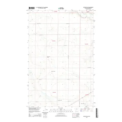
2014 Map of Antelope Lake
USGS Topo · Published 2014About this map
Teton River carves through the northern reaches of this high plains landscape in Chouteau County. The terrain is defined by a network of drainage systems, notably Antelope Coulee and Weatherwax Coulee, which channel seasonal runoff toward the primary river valley. Surveyed in the early twenty-first century, the map reveals a systematic grid of section lines and rural access routes like Carter Rd W and Floweree Rd W that reflect the enduring importance of large-scale agriculture and land management in this portion of Montana. The elevation contours illustrate the subtle but significant breaks and benches that separate the rolling uplands from the lower coulee floors.
Find a feature on this map
1 named feature on this map. Tap any name to fly to it.
Don’t see what you’re looking for? This feature index may not catch every label — zoom into the map to look around manually.
Map Details
Editions of this 2014 Antelope Lake Map
This is the sole edition of this map. No revisions or reprints were ever made.
Other maps of this area

1886 · Great Falls
USGS Topo · 1:250,000

1890 · Fort Benton
USGS Topo · 1:250,000

1892 · Fort Benton
USGS Topo · 1:250,000

1897 · Fort Benton
USGS Topo · 1:250,000

1948 · Portage
USGS Topo · 1:62,500

1949 · Portage
USGS Topo · 1:62,500

1950 · Dent Bridge
USGS Topo · 1:62,500

1953 · Carter
USGS Topo · 1:24,000

1954 · Great Falls
USGS Topo · 1:250,000

1954 · Lander Crossing
USGS Topo · 1:24,000