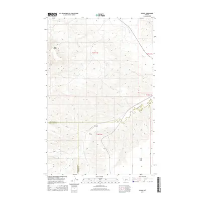
2017 Map of Pownal
USGS Topo · Published 2017About this map
Pownal serves as a central anchor in this modern survey of the central Montana high plains, where the borders of Fergus, Chouteau, and Judith Basin counties converge. The landscape is defined by its dramatic topographic shifts, most notably the prominent Square Butte in the northwest and the expansive Arrow Creek Bench to the south. This area is heavily dissected by a complex network of seasonal and perennial watercourses, including the winding Arrow Cr and its tributaries like Surprise Cr, Little Battle Cr, and Butte Cr. These drainages have carved distinctive features such as Ole Coulee, illustrating the erosional patterns of the regional terrain. Grounded in 2016 NAIP imagery and updated road data, the map traces local thoroughfares like Pownal Rd and Co Rd 201 as they navigate the ridges and valleys of this ranching and agricultural territory.
Find a feature on this map
21 named features on this map. Tap any name to fly to it.
Don’t see what you’re looking for? This feature index may not catch every label — zoom into the map to look around manually.
Map Details
Editions of this 2017 Pownal Map
This is the sole edition of this map. No revisions or reprints were ever made.
Other maps of this area

1890 · Fort Benton
USGS Topo · 1:250,000

1892 · Fort Benton
USGS Topo · 1:250,000

1897 · Fort Benton
USGS Topo · 1:250,000

1954 · Great Falls
USGS Topo · 1:250,000

1957 · Great Falls
USGS Topo · 1:250,000

1972 · Square Butte SE
USGS Topo · 1:24,000

1972 · Square Butte
USGS Topo · 1:24,000
1978 · Strouf Island
USGS Topo · 1:24,000

1978 · Leiberg Coulee
USGS Topo · 1:24,000
1978 · Geraldine
USGS Topo · 1:24,000