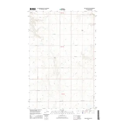
2017 Map of Eagle Buttes SW
USGS Topo · Published 2017About this map
Sherry Coulee and Crow Coulee carve through the high plains of Chouteau County, defining the drainage patterns of this sparsely populated ranching and agricultural landscape. The 2017 terrain is structured by a grid of rural tracks including Hardwood Lake Rd and Clear Lake Rd, which provide access to remote land parcels across Township 24 North. This environment is typical of the Montana plains, where the land is managed through the Public Land Survey System, as seen in the prominent boundaries of t24n r12e and its neighbors. Names like Tadej Ln and Roudabush Ln suggest local family ties to the land, while infrastructure such as Pump Station Rd points toward the logistical requirements of managing water and utilities in this arid region. The network of trails, such as Citadel Trl, serves as the primary connection for the isolated farmsteads and range lands.
Find a feature on this map
16 named features on this map. Tap any name to fly to it.
Don’t see what you’re looking for? This feature index may not catch every label — zoom into the map to look around manually.
Map Details
Editions of this 2017 Eagle Buttes SW Map
This is the sole edition of this map. No revisions or reprints were ever made.
Other maps of this area

1890 · Fort Benton
USGS Topo · 1:250,000

1892 · Fort Benton
USGS Topo · 1:250,000

1897 · Fort Benton
USGS Topo · 1:250,000

1953 · Eagle Buttes
USGS Topo · 1:24,000

1953 · Big Bend School
USGS Topo · 1:24,000

1953 · Pilot Rock
USGS Topo · 1:24,000

1953 · Stranahan
USGS Topo · 1:24,000

1954 · Great Falls
USGS Topo · 1:250,000

1957 · Great Falls
USGS Topo · 1:250,000
1972 · Eagle Buttes SW
USGS Topo · 1:24,000