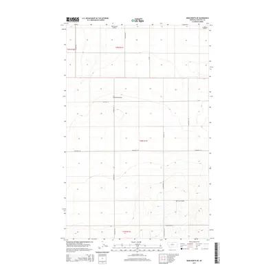
2014 Map of Kenilworth NE
USGS Topo · Published 2014About this map
Lonesome Prairie dominates the landscape of north-central Chouteau County in this 2014 survey. The area is defined by the deep incisions of Twelvemile Coulee in the north and Dry Fork Coulee to the south, which break the high plains terrain. This specific quadrangle reflects a legacy of large-scale land management and dryland farming, visible in the sprawling sections of the Public Land Survey System including t28n r11e and t27n r11e. The road network provides evidence of early settlement patterns and family history, with routes like Homesteader Ln, Reichelt Ln, and Blankenbaker Rd likely tracing the boundaries of original land claims. These namesake roads and the central Kenilworth Rd reveal how the interior of the Big Sky state was organized long after the initial frontier era.
Find a feature on this map
16 named features on this map. Tap any name to fly to it.
Don’t see what you’re looking for? This feature index may not catch every label — zoom into the map to look around manually.
Map Details
Editions of this 2014 Kenilworth NE Map
This is the sole edition of this map. No revisions or reprints were ever made.
Other maps of this area

1904 · Boxelder
USGS Topo · 1:62,500

1906 · Lonesome
USGS Topo · 1:62,500

1906 · Boxelder
USGS Topo · 1:62,500

1919 · Big Sandy
USGS Topo · 1:125,000

1953 · Boggs Island
USGS Topo · 1:24,000

1953 · Verona
USGS Topo · 1:24,000

1954 · Shelby
USGS Topo · 1:250,000

1958 · Shelby
USGS Topo · 1:250,000

1969 · Fourteenmile Coulee SW
USGS Topo · 1:24,000
1969 · Lonesome Lake
USGS Topo · 1:24,000