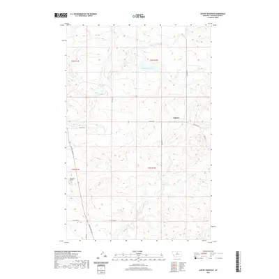
2020 Map of Seifort Reservoir
USGS Topo · Published 2020About this map
Eagleton and the surrounding high plains of Chouteau County define this landscape, characterized by a complex network of intermittent drainages and modest ranch roads. The terrain is dominated by the deeply incised valleys of Dog Cr, Eagle Cr, and Chip Cr, which carve through the plateau toward larger regional watercourses. A prominent topographic landmark, Haystack Butte, rises in the southwest, providing a natural navigational point for this part of the state.
Find a feature on this map
19 named features on this map. Tap any name to fly to it.
Don’t see what you’re looking for? This feature index may not catch every label — zoom into the map to look around manually.
Map Details
Editions of this 2020 Seifort Reservoir Map
This is the sole edition of this map. No revisions or reprints were ever made.
Other maps of this area

1953 · Havre
USGS Topo · 1:250,000

1954 · Iliad
USGS Topo · 1:24,000

1954 · Dark Butte
USGS Topo · 1:24,000

1954 · Lewistown
USGS Topo · 1:250,000

1957 · Havre
USGS Topo · 1:250,000

1958 · Havre
USGS Topo · 1:250,000

1959 · Lewistown
USGS Topo · 1:250,000

1959 · Warrick
USGS Topo · 1:62,500

1959 · Centennial Mountain
USGS Topo · 1:62,500

1964 · Pigtail Coulee
USGS Topo · 1:24,000