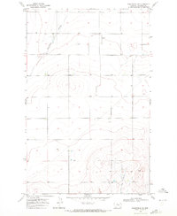
1969 Map of Kenilworth NE
USGS Topo · Published 1972About this map
Twelvemile Coulee winds through the northern portion of this rural landscape in Montana's Chouteau County, providing a primary drainage feature for the surrounding prairie. This 1960s-era topography illustrates the high-plains ranching environment before modern development, characterized by wide-open terrain and sparse, functional improvements. Educational needs for the isolated ranching families were served by the Lincoln Sch located in the northwest corner, a remnant of the early school district system that consolidated many rural townships. The southern extent is defined by the headwaters of Dry Fork Coulee, while the map records the infrastructure of the day, including a private Landing Strip and a deep Well. These features indicate the logistical requirements of maintaining large-scale agricultural operations in an arid, expansive environment far from established town centers.
Find a feature on this map
7 named features on this map. Tap any name to fly to it.
Don’t see what you’re looking for? This feature index may not catch every label — zoom into the map to look around manually.
Map Details
Editions of this 1969 Kenilworth NE Map
This is the sole edition of this map. No revisions or reprints were ever made.
Other maps of this area

1904 · Boxelder
USGS Topo · 1:62,500

1906 · Lonesome
USGS Topo · 1:62,500

1906 · Boxelder
USGS Topo · 1:62,500

1919 · Big Sandy
USGS Topo · 1:125,000

1953 · Boggs Island
USGS Topo · 1:24,000

1953 · Verona
USGS Topo · 1:24,000

1954 · Shelby
USGS Topo · 1:250,000

1958 · Shelby
USGS Topo · 1:250,000

1969 · Fourteenmile Coulee SW
USGS Topo · 1:24,000
1969 · Lonesome Lake
USGS Topo · 1:24,000