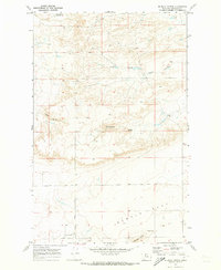
1970 Map of Mc Bridy Spring
USGS Topo · Published 1973About this map
McBridy Spring serves as a focal point in this high-plains landscape of Chouteau County, where the terrain transitions from the broken draws of North Fork Dugout Coulee to the broad expanse of Sample Flat. The map documents a sparsely populated ranching environment during the early 1970s, characterized by intermittent water sources and the strategic management of the land. Evidence of local aviation and agricultural logistics is seen in the presence of Landing Strips and clustered Storage Bins near the southern boundary. To the north, the White Elephant Reservoir and named drainage features like Hells Gulch illustrate how water—and the lack of it—dictated the placement of infrastructure. Connectivity is limited to routes like the Dent Bridge Road, which skirts the base of Haystack Butte as it navigates the elevation changes between the township lines of T. 27 N. and T. 26 N.
Find a feature on this map
11 named features on this map. Tap any name to fly to it.
Don’t see what you’re looking for? This feature index may not catch every label — zoom into the map to look around manually.
Map Details
Editions of this 1970 Mc Bridy Spring Map
This is the sole edition of this map. No revisions or reprints were ever made.
Other maps of this area

1886 · Great Falls
USGS Topo · 1:250,000

1949 · Timber Coulee
USGS Topo · 1:62,500

1950 · Timber Coulee
USGS Topo · 1:62,500

1950 · Dent Bridge
USGS Topo · 1:62,500

1954 · Great Falls
USGS Topo · 1:250,000

1954 · Shelby
USGS Topo · 1:250,000

1957 · Great Falls
USGS Topo · 1:250,000

1958 · Shelby
USGS Topo · 1:250,000

1970 · Carlson Coulee
USGS Topo · 1:24,000

1970 · Knees NE
USGS Topo · 1:24,000