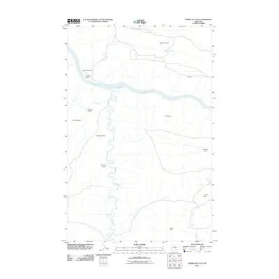
2011 Map of Starve Out Flat
USGS Topo · Published 2011About this map
The Missouri River cuts through this portion of Fergus County, creating a distinct topographical divide between the northern benches and the intricate coulee systems to the south. Sneath Bottom and Cap Rock Ridge overlook the river's path, while the winding Arrow Creek flows northward to meet the main channel. To the south, the landscape is defined by massive natural depressions known as The Big Sag and The Little Sag, alongside dramatic rises like Cherry Top. Local ranching history is anchored by the P N Ranch in the southeast, situated near Cow Camp Spring. The area's geography is further shaped by expansive plateaus like Eightmile Bench and Canavan Bench, which provide high-ground perspectives over the river valley. Sparse infrastructure, such as Eight Mile Bench Rd, serves this ranchland terrain where water sources like Lohse Spring remain vital landmarks.
Find a feature on this map
19 named features on this map. Tap any name to fly to it.
Don’t see what you’re looking for? This feature index may not catch every label — zoom into the map to look around manually.
Map Details
Editions of this 2011 Starve Out Flat Map
This is the sole edition of this map. No revisions or reprints were ever made.
Other maps of this area

1953 · Starve Out Flat
USGS Topo · 1:24,000

1953 · Last Chance Bench
USGS Topo · 1:24,000

1954 · P N Ranch
USGS Topo · 1:24,000

1954 · Iliad
USGS Topo · 1:24,000

1954 · Dark Butte
USGS Topo · 1:24,000

1954 · Lewistown
USGS Topo · 1:250,000

1959 · Lewistown
USGS Topo · 1:250,000

1964 · Wolf Creek Falls
USGS Topo · 1:24,000

1964 · Pigtail Coulee
USGS Topo · 1:24,000

1964 · Spring Coulee
USGS Topo · 1:24,000